Mike Schaefer, Trustee for TNC Washington reflects on his 40+ years of activism in the LGBTQ+ community, his passion for the environment, and how the lessons he has learned have overlapped between the two.

Washington shellfish growers receive funding from the Supporting Oyster Aquaculture and Restoration (SOAR) program’s Shellfish Growers Resiliency Fund, investments in new and more sustainable solutions to common aquaculture practices.
Earth Day was born out of a movement to improve the lives of people and nature, inspiring sweeping legislative action and investments. Today, federal infrastructure funding and WA Climate Commitment Act are a continuation of this movement, investments making a tangible impact locally. As an example, Washington’s historic funding of the Floodplains by Design program is contributing to nature-based floodplain management across the state to reduce flood risk, protect communities and protect salmon habitat. These state and federal dollars are just the start of local climate action that will improve the daily lives and the future of all Washingtonians.
Meet DeAnne Hamilton: Learn how the general manager of Tacoma’s KBTC Public Television and TNC in Washington trustee, uses the power of storytelling to engage people in conservation and create a better future for the next generation.
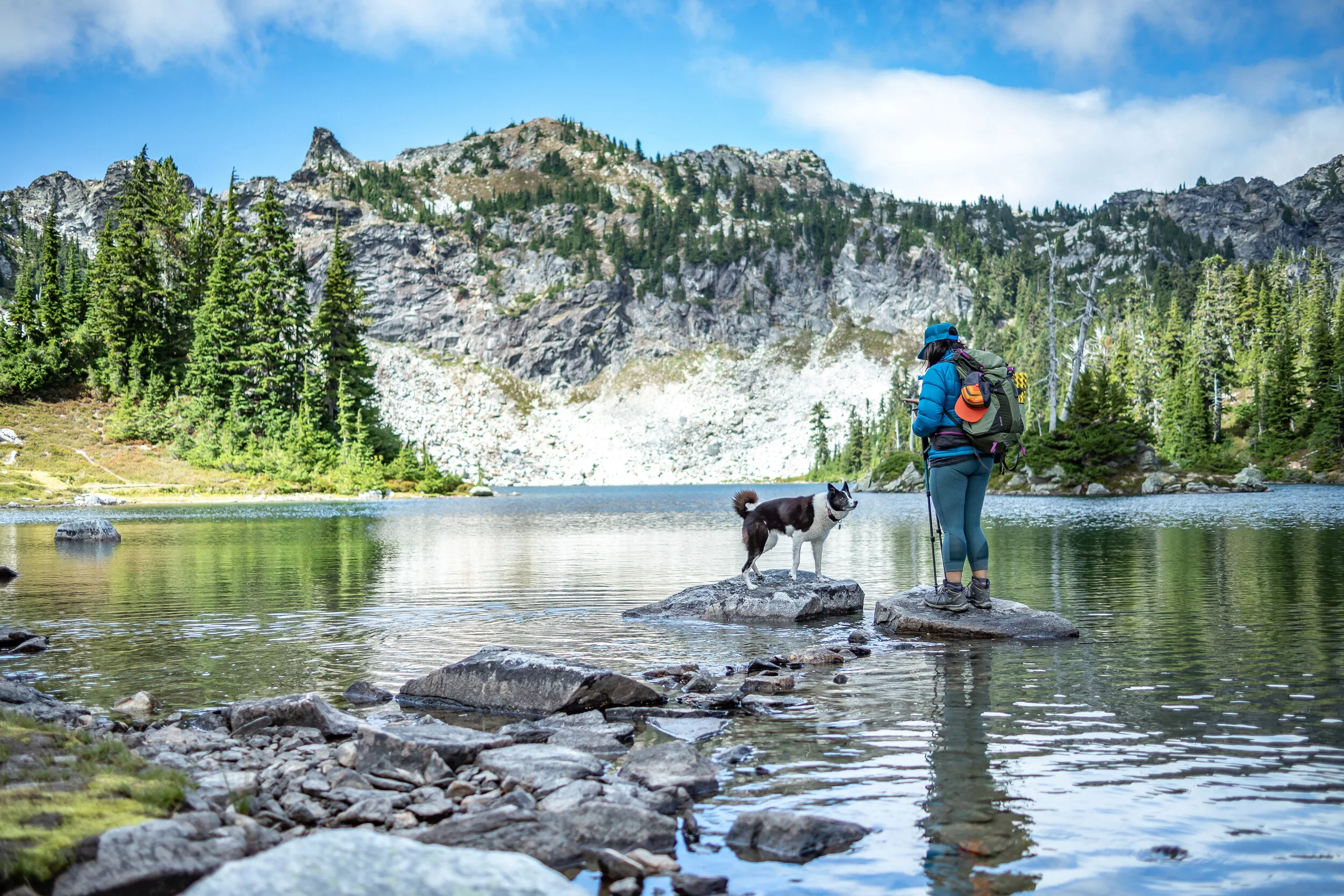
Nestled in the cliffs in Moses Coulee is an import desert water sources that every springs attracts thousands of Pacific Tree frogs. I came to Whisper Lake for a night concert. It was anything but quiet. The chorus of frogs was soothing, calming—the quintessential sound of spring.
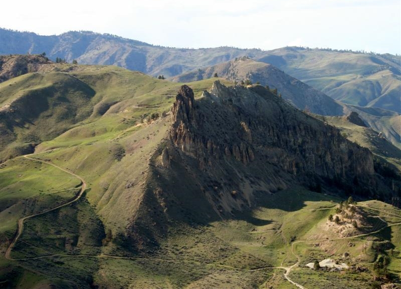
The Cle Elum Wildlife Project is improving our understanding of how wildlife use and move through protected forest landscapes, providing us with an opportunity to test how forest management practices impact wildlife and building an evidence base for permanent protection.
Written & Photographed by Tu Do, Freelance Cinematographer
I once made it a goal to experience the sunrise and the sunset every day for an entire year. There is a beautiful quote that says, "There's a sunrise and a sunset everyday. And you can choose to be there for it or you can put yourself in the way of beauty." And I took that to heart. I learned from that experience that no matter how routine my day was, the sunrise and sunset never looked the same.
I am very grateful to be able to experience the beauty that the Northwest offers. Having spent a lot of my youth in the flat lands of Florida, I love driving around the winding roads of Oregon and Washington, always something new around the corner. It can be a snow capped mountain, giant sand dunes, pristine lakes, and towering waterfalls.
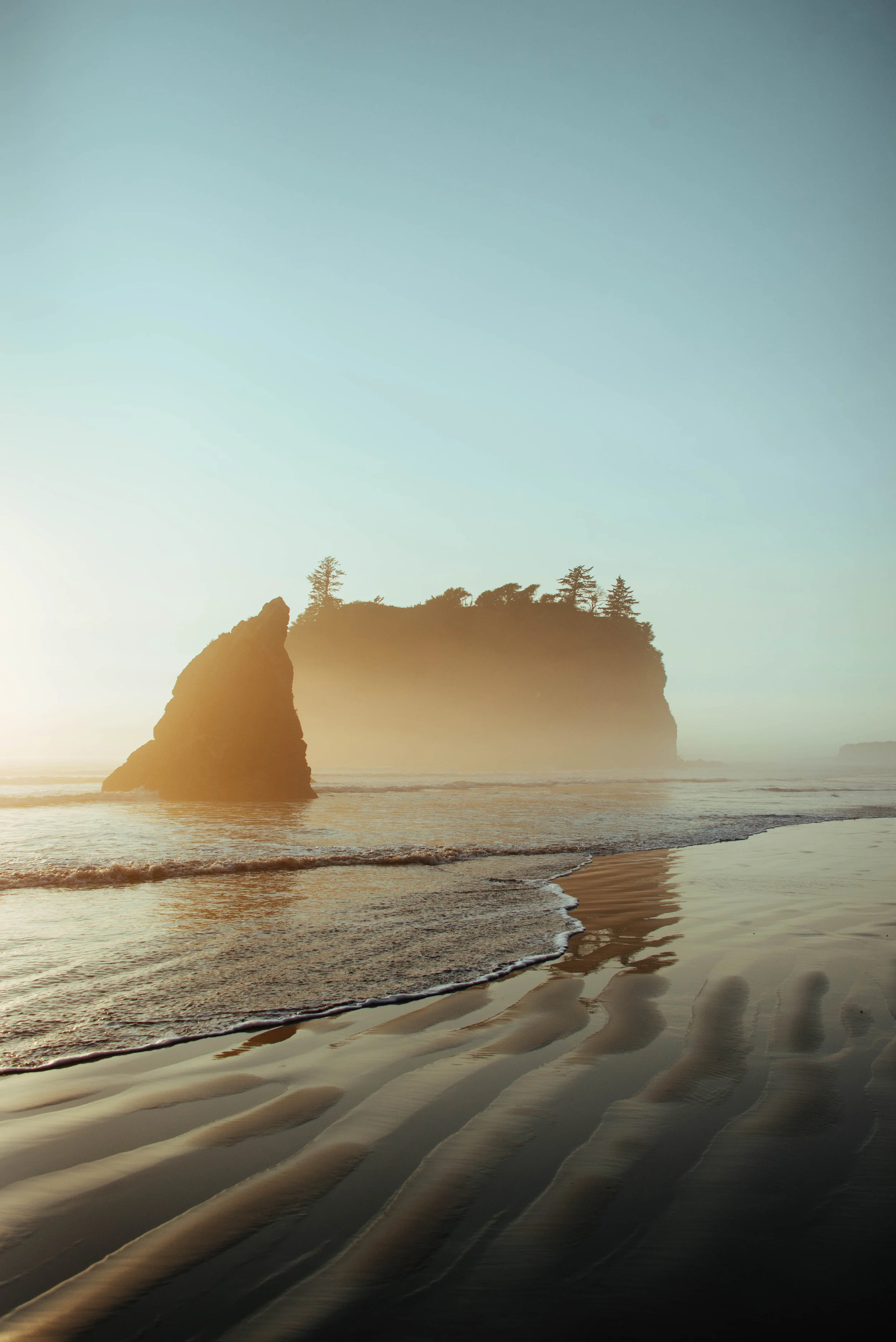
This photo was taken right at the end of the day at Second Beach near La Push. Many folks had set up tents and bonfires, enjoying this beautiful afternoon. As the skies started to wash into a twilight blue and purple, many people began to walk back to their cars. I had a feeling the sun wasn't quite done with impressing us all. So my girlfriend and I sat and enjoyed the view for a little longer, and the sun peeked behind the clouds one last time and set the sky ablaze. It only lasted a good 5 minutes so I asked my lovely lady to pose between the two rocks and created my favorite shot from the evening.
Nature truly never ceases to amaze. As we all go about our day, don't ever forget to look around your surroundings. It's the moments that you don't expect that you'll always remember.
Tu Do is a roaming cinematographer that has spent time all over the United States. Currently based in San Francisco traveling the world and shooting cool content for Twitch. You can find more of his film work at www.twodough.com and his photography on Instagram: @twodough.
Not every outdoors adventure leads to your destination or the perfect photo. Often, lots of persistence and patience is required.
Landscape photography is a pursuit that gets Jake Gosline out into nature and helps to keep him grounded.
This month’s featured photo captures the pivot from summer to fall in the Tieton Canyon.
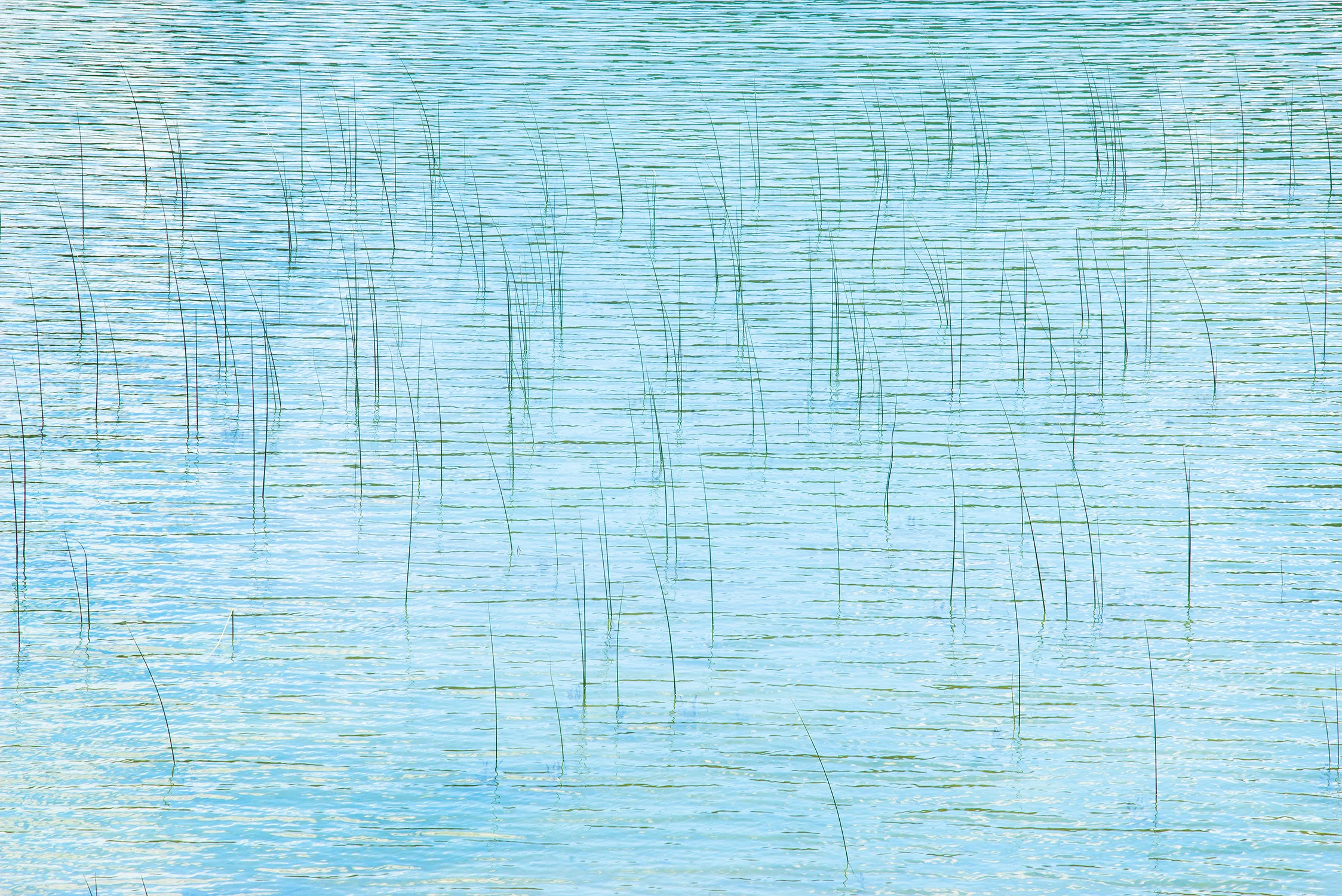
At Park Lake, the waves were no longer moving water — they were but stands of a hair on a bow, moving across the reeds, like the strings of a violin.
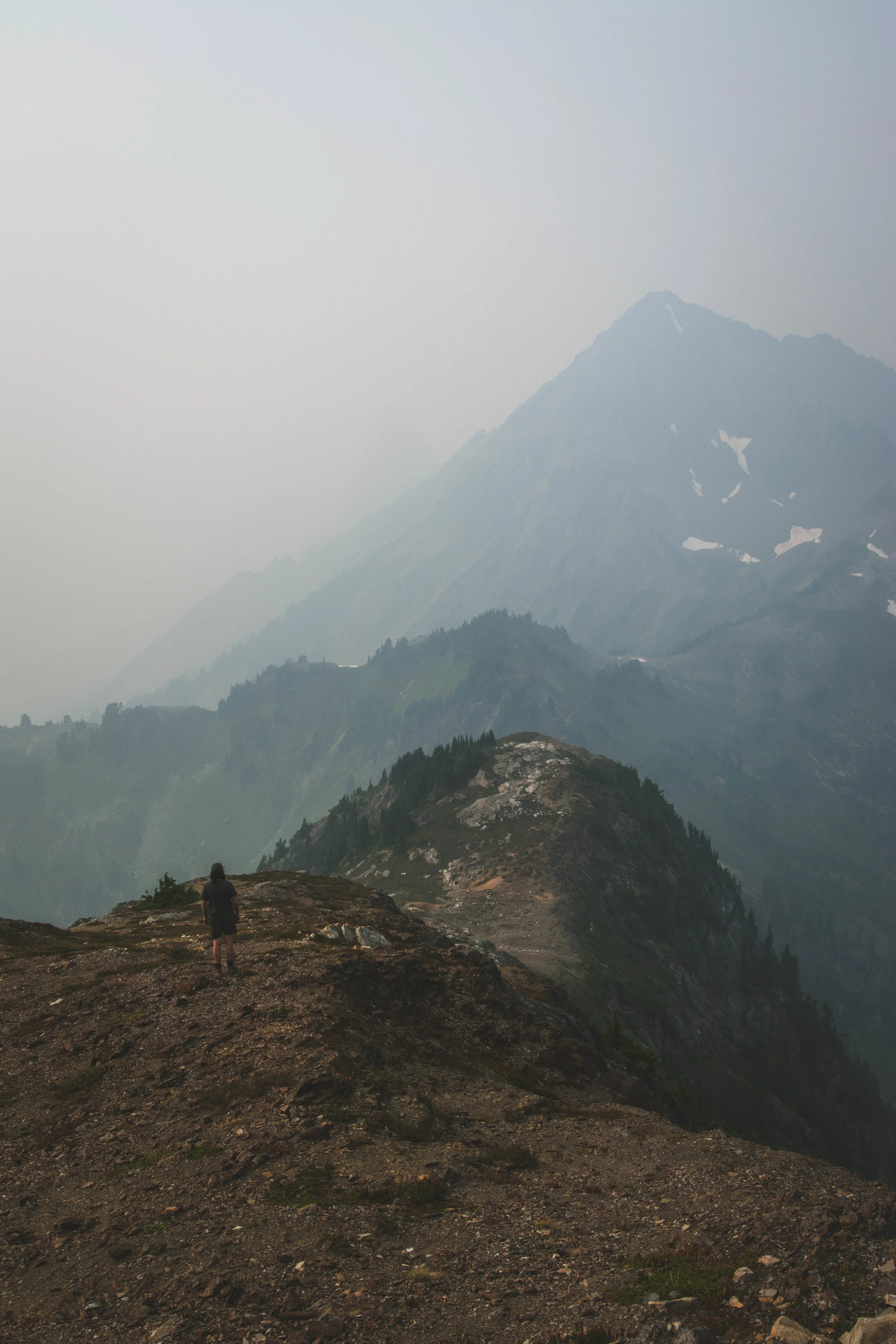
Photographer Cory Zanker revisits a favorite hiking destination, only to find the view obscured by smoke from Western wildfires. He made the most of the situation and found the silver lining.
For Jerad Armijo, photography is soothing, surreal and a fantastic way for him to cope with depression while creating beauty for others to enjoy.
For this photographer of the month, photography is a way to more fully experience life. He doesn’t think of it as hiding behind a lens, removed from life.
We have all been there. It’s easy to feel overwhelmed and not recognize the crucial need for fresh air. A minimal escape can reset your mentality in a crucial way.
Not only does Matt MacPherson find the light of sunsets and sunrises beautiful and exciting, but he likes spending the time in between doing grueling day hikes without having to get his camera gear out.
During backcountry trips, Alex Spaeth is inspired by landscapes both big and small that make him pause and think how fortunate he is to be there to appreciate fleeting, yet lasting, moments.
Photography provides this photographer a means to capture and absorb some of the beautiful places he has been lucky enough to explore and share those experiences with others.
Photography has pushed Riley Rhodes out of his comfort zone and has helped him with social anxiety. What matter is that I’m happy with the art that I am creating.
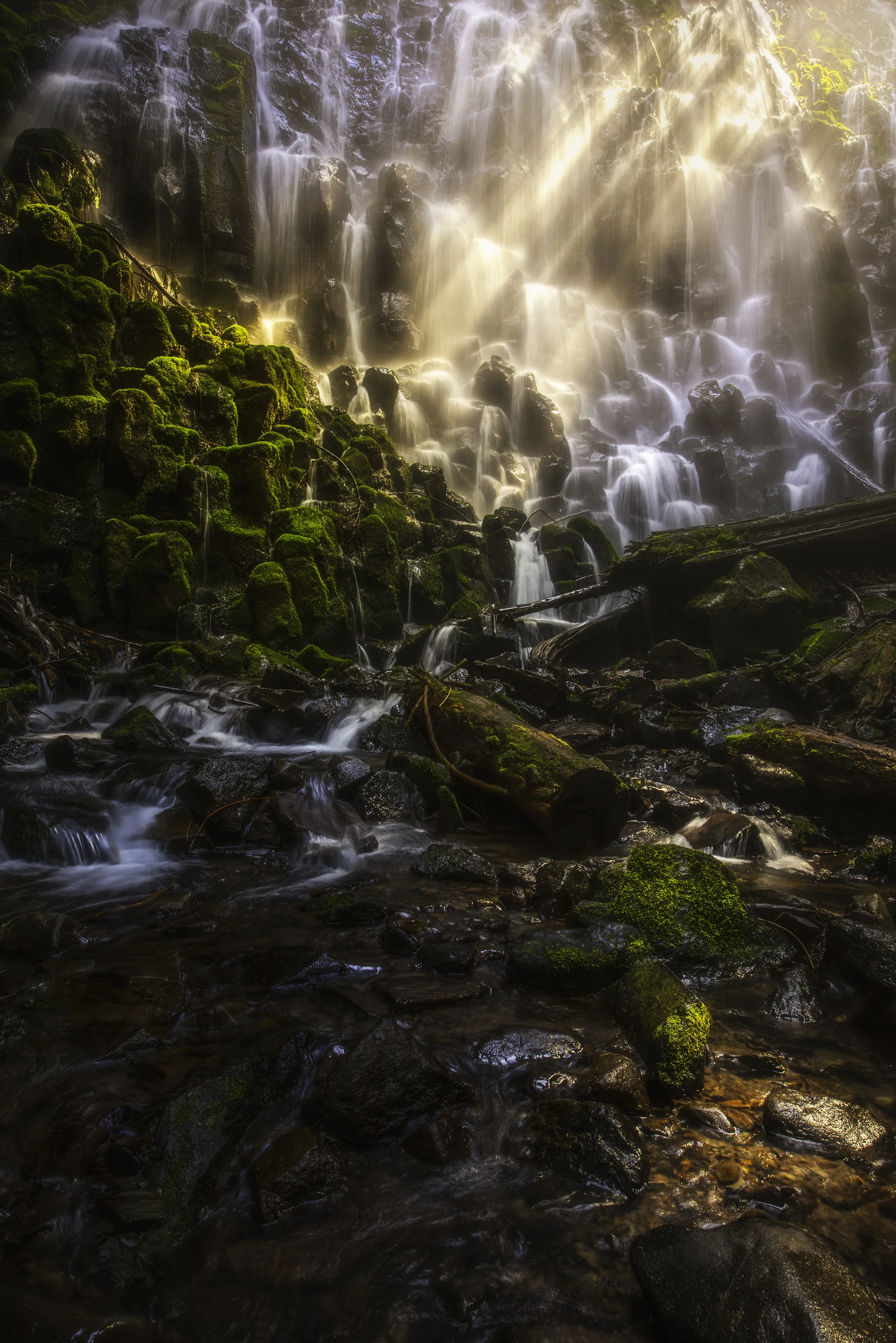
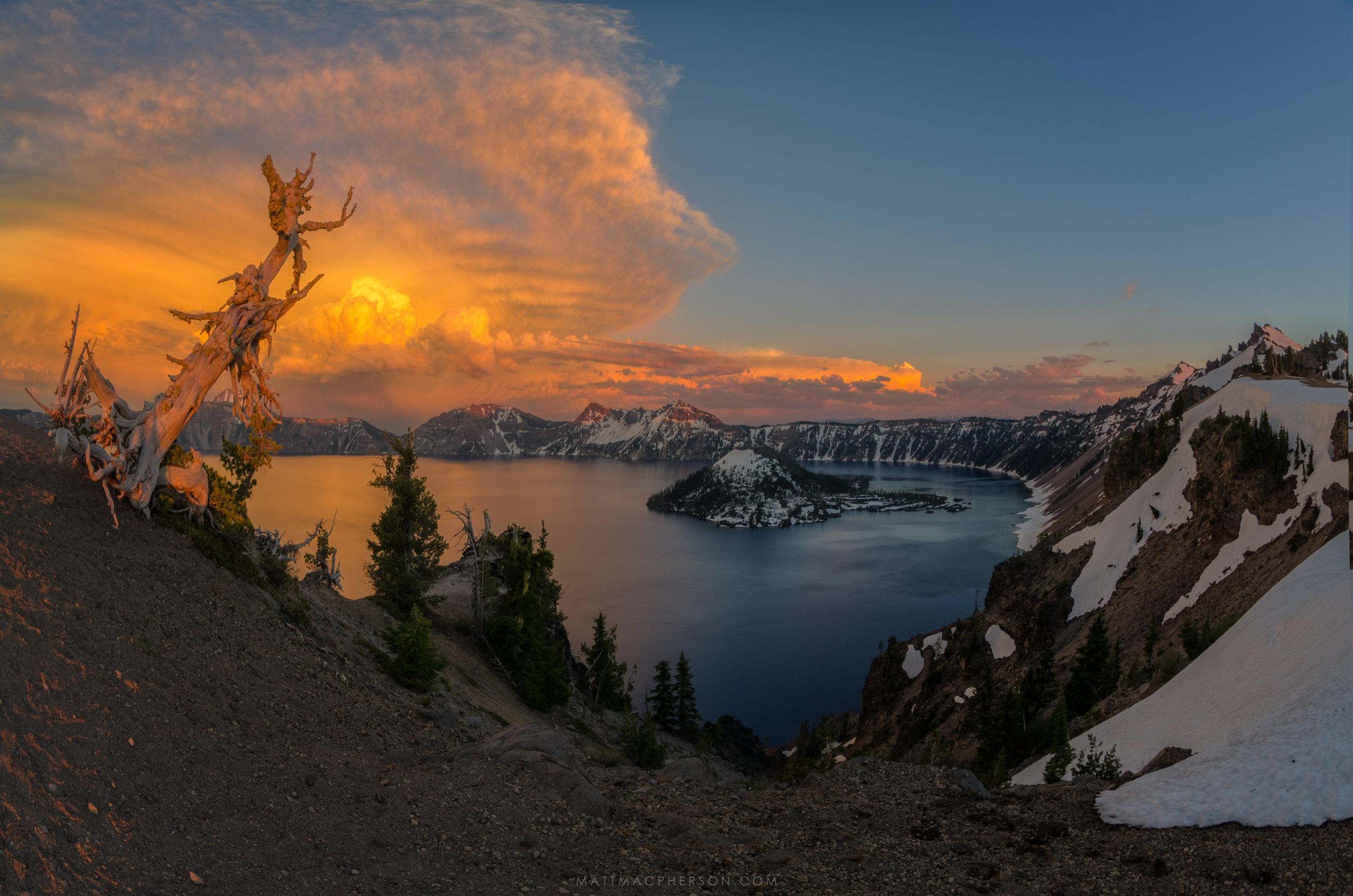
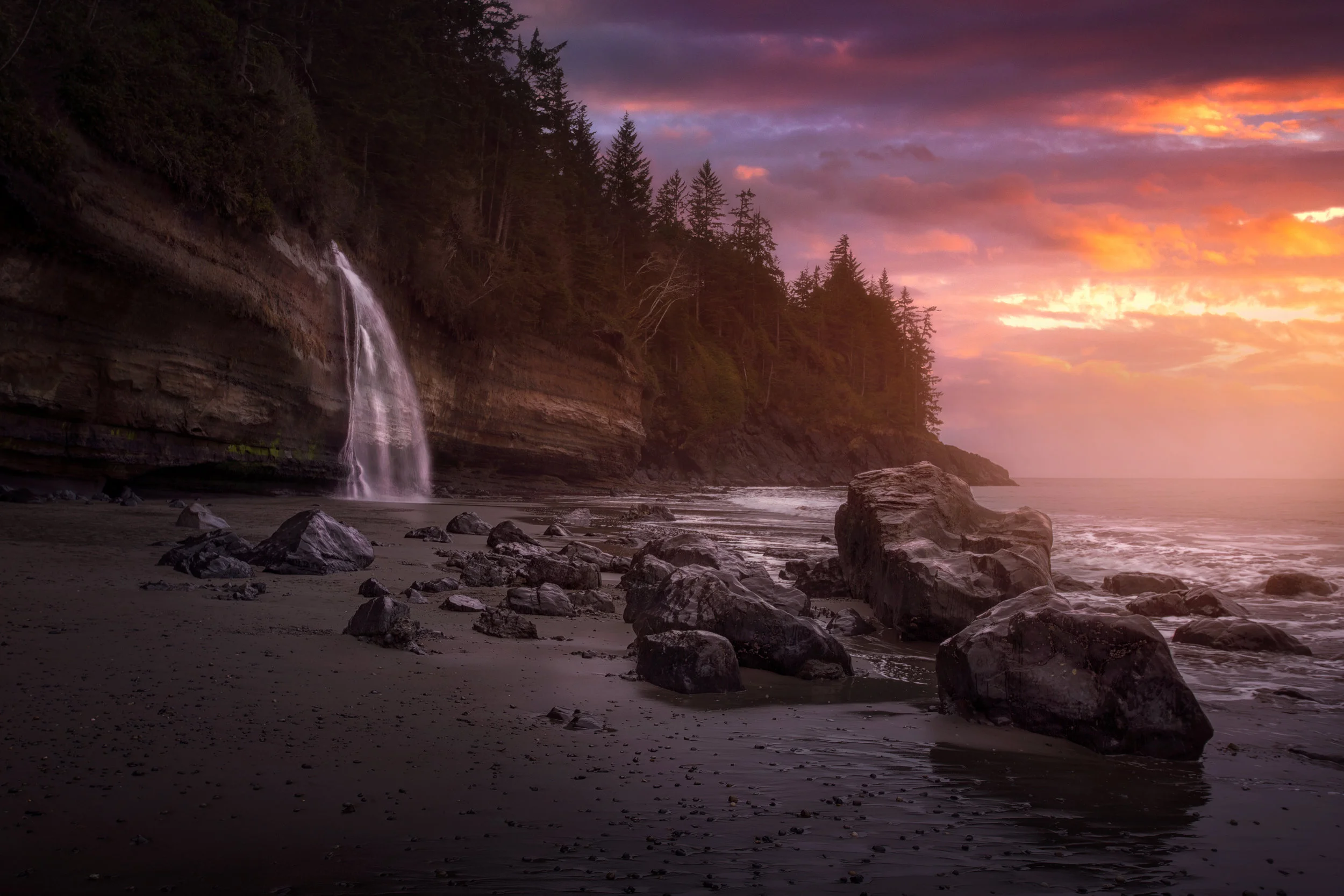
January's photo of the month is like something out of a storybook: A giant waterfall flows off of a cliff and into the sea during an epic sunset.
"Nature speaks what is written upon it, and anyone who reads and acknowledges with an open heart will receive the positivity it speaks," writes our photographer of the month.
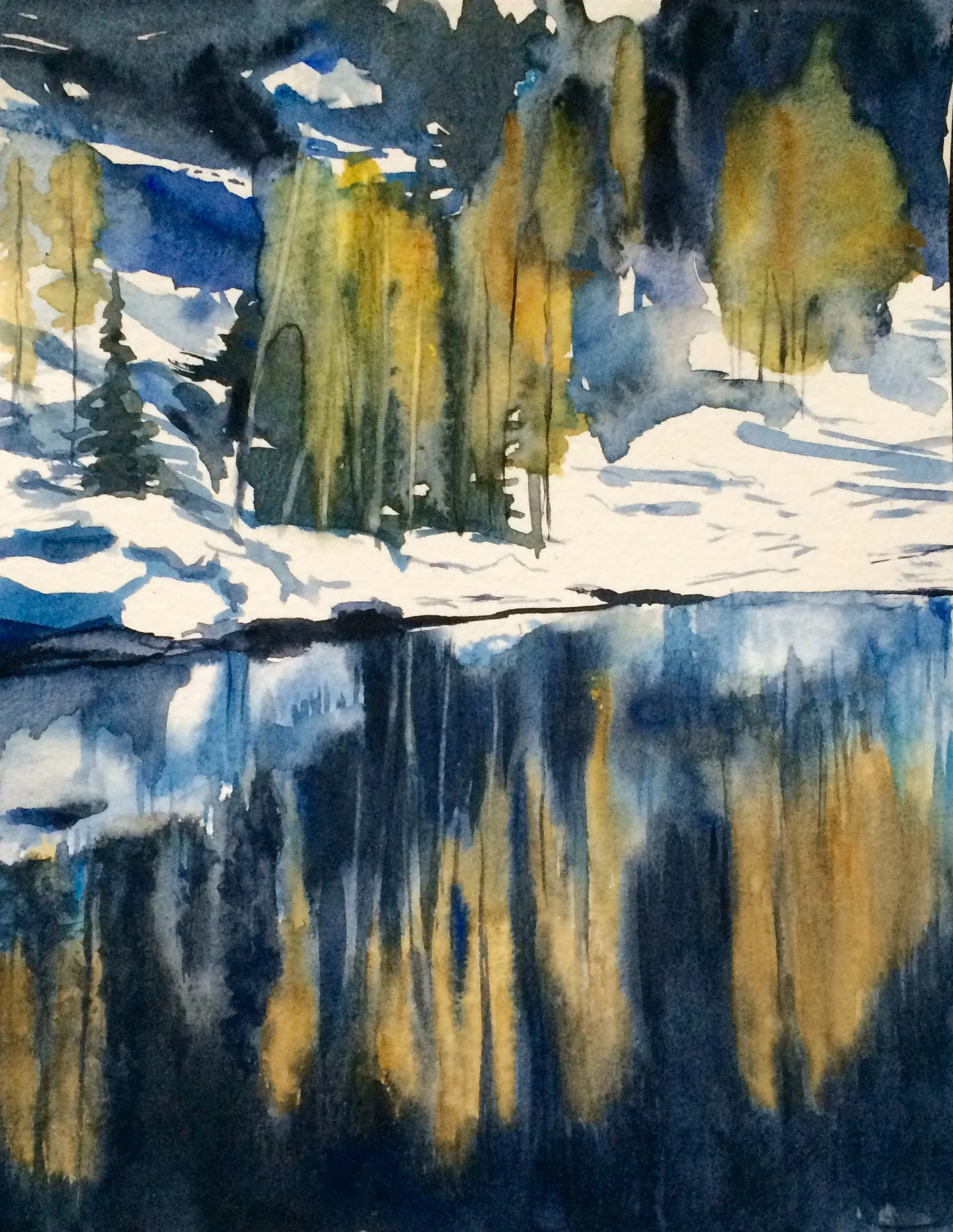
November's "photo" of the month takes some artistic liberties: alpine larch trees reflected in water paint a picturesque watercolor painting.
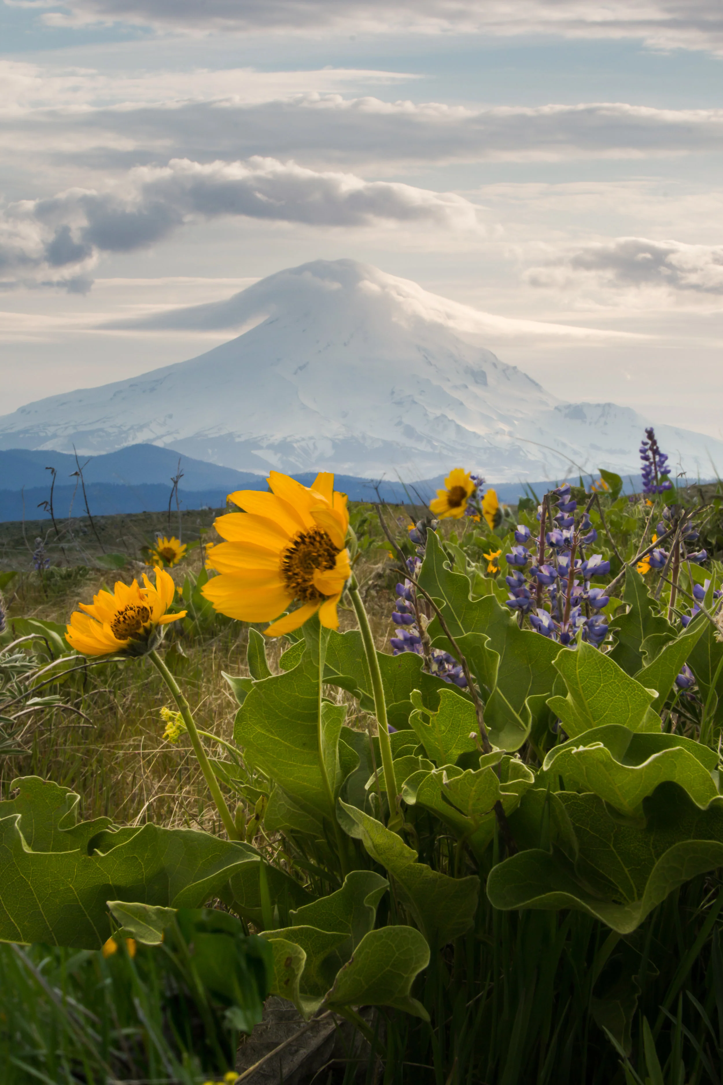
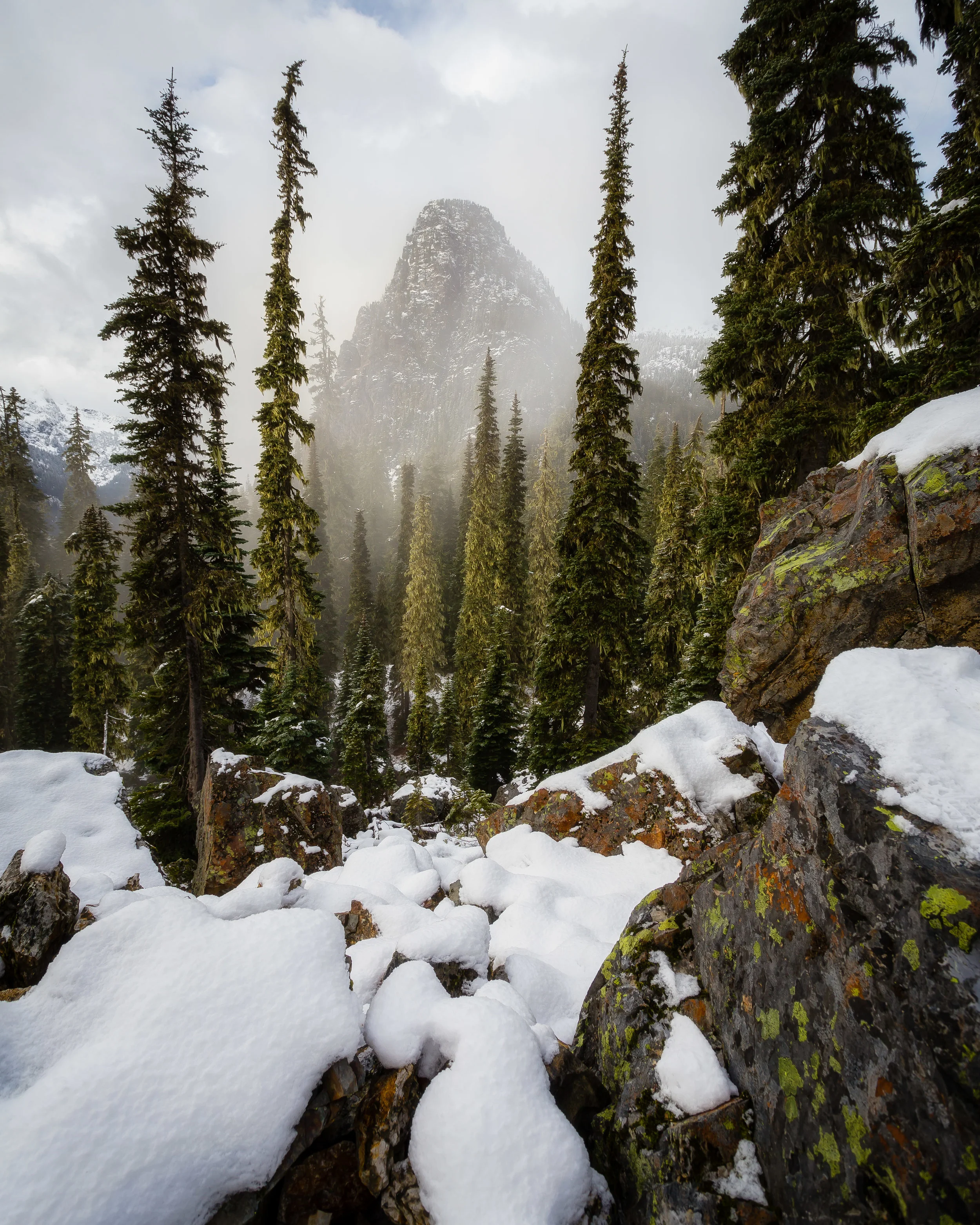
Our photographer of the month learned that his preconceptions about "the perfect photo" quickly dissipated as the sun rose over Glacier Peak.
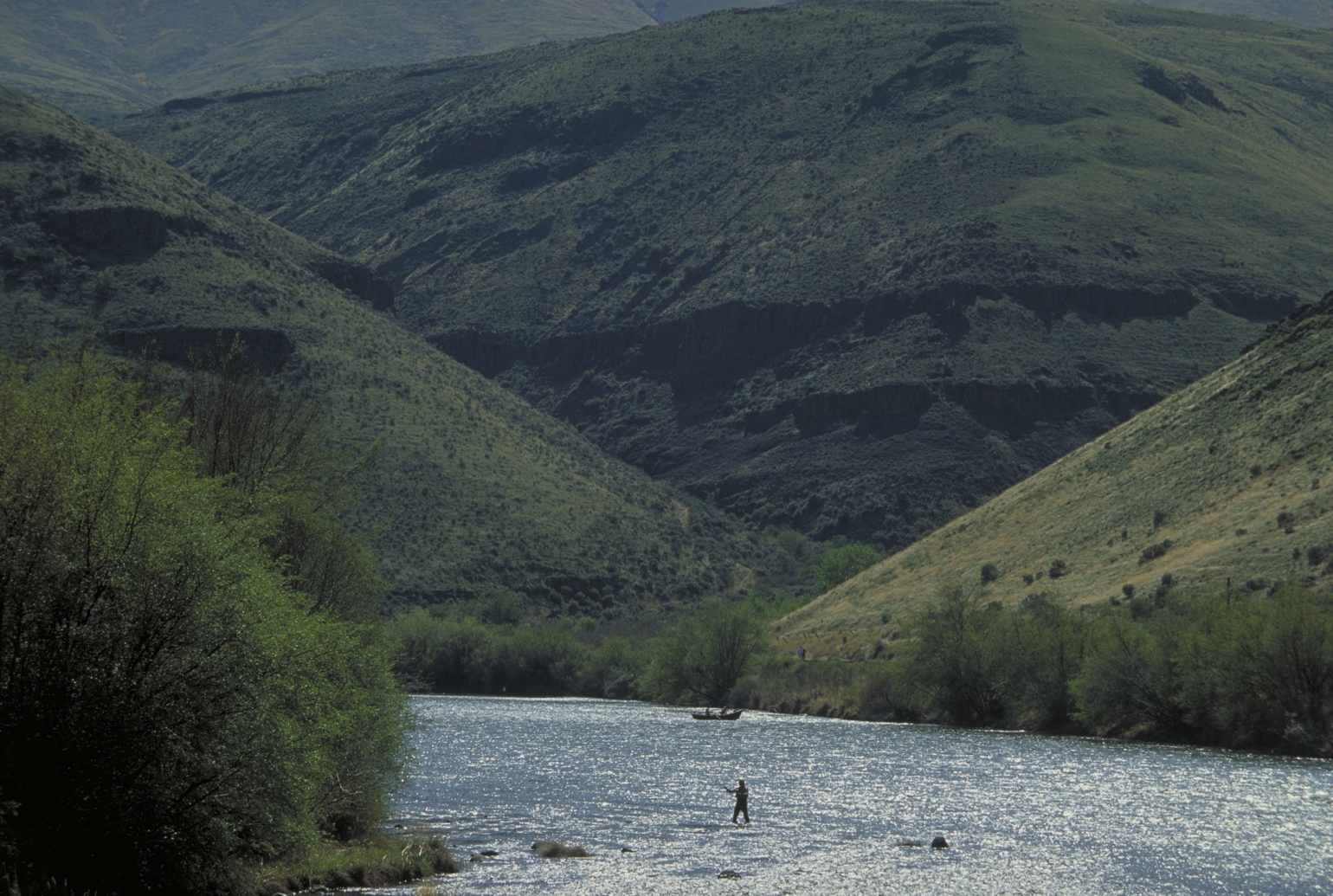
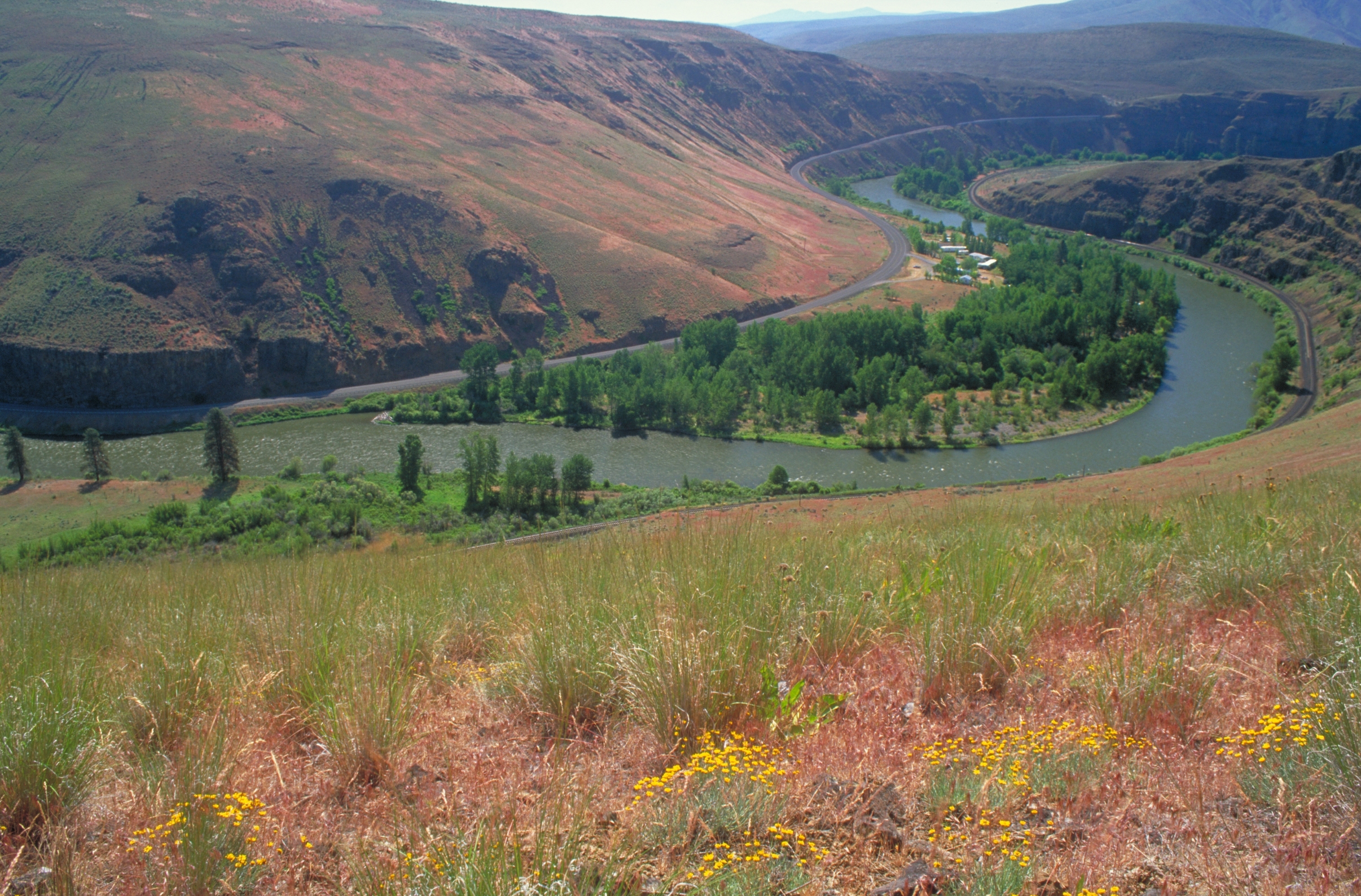
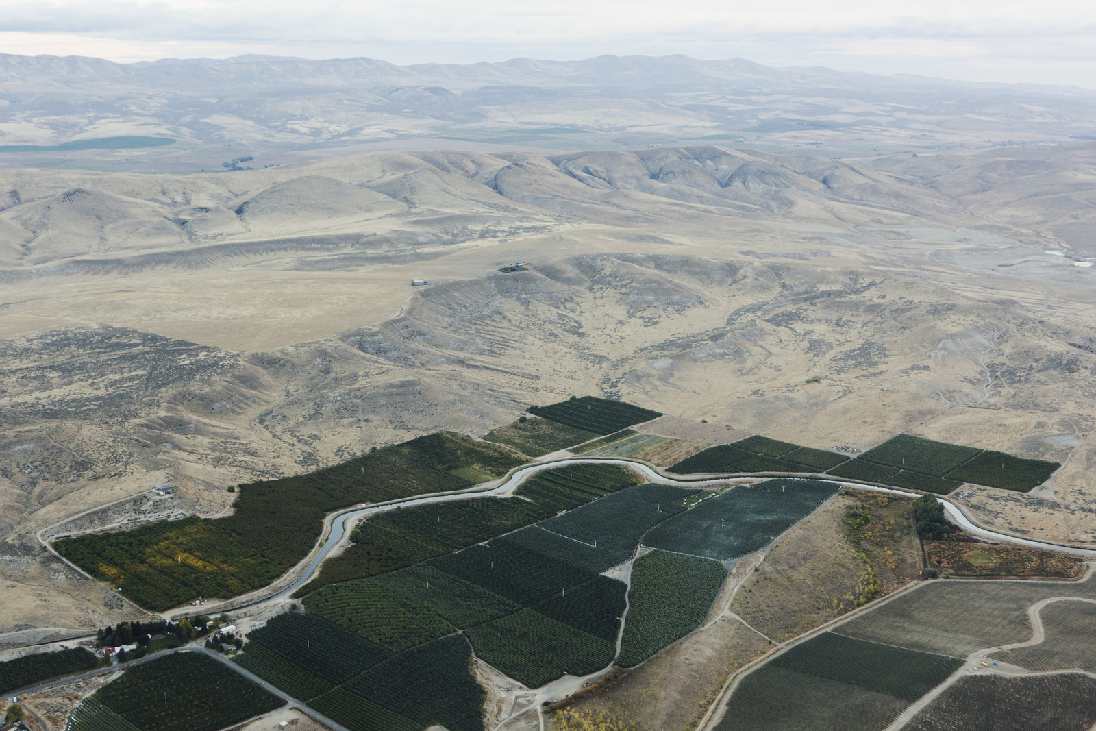
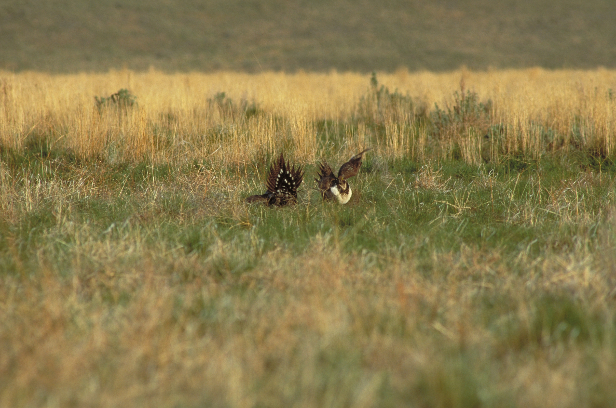
Guest post by Nicky Pasi, Conservation Outreach Associate, American Rivers
Photographs by Keith Lazelle; Benj Drummond/LightHawk
There are so many proverbs, pithy quips and wry one-liners about western water conflicts, you could bind them up in a respectably thick book. But here’s a new one, less of a joke than it might seem:
“An irrigator, an environmentalist, and a tribal member walk into a Senator’s office … and the room doesn’t erupt?”
Question mark intentional. It’s an unexpected scenario, but it’s exactly how the people of the Yakima Basin have decided to address their many, often conflicting, demands on water.
All of these needs – tribal, agricultural, recreational, environmental - are kept afloat by the Yakima River. And all are threatened by climate change.
Warmer winters and hotter summers empty our reservoirs, prevent snowpack from accumulating to refill them, and raise in-stream temperatures to dangerous highs. Drought threatens salmon and trout, while farmers let fields fallow and orchards die, and fires keep hikers out of the woods.
That’s a lot of struggling users, and in 2009, the groups advocating for each did something really extreme. They stopped throwing rocks (read: lawsuits) at one another. They came out from behind entrenched positions. They mapped out their needs, compared those against their wants, and went to work negotiating between the two.
The result was the Yakima Basin Integrated Plan, a compromise so broad and interwoven that Deputy Secretary of the Interior Michael Connor has called it “a model – not just for working through watershed challenges, but for any natural resources management [issues].”
These stakeholders – our irrigators, environmentalists, tribal leaders and management agencies- took their plan to Senator Maria Cantwell, who recognized the importance of such an unusual partnership. In 2015 she and Senator Patty Murray introduced legislation to provide federal authorization for the first decade of Yakima Plan projects.
Last November, the Yakima Bill unanimously passed out of the Senate Energy and Natural Resources Committee. In April, it was amended to the Senate Energy Policy Modernization Act of 2016 (also unanimously), which then passed out of the Senate by a vote of 85-12. As the Yakima Herald Editorial Board put it, “the success of [the Yakima Bill] so far speaks to the collaboration of the various stakeholders and the bipartisan cooperation of the state’s congressional delegation.” The Energy Bill now moves on to the House of Representatives, where Yakima Basin Representatives Reichert and Newhouse set the stage by introducing a companion Yakima Bill back in February.
So here’s the punch line, which isn’t actually a punch line at all, but rather the thread that ties the whole package together: cooperative compromise.
As with any compromise, there is give and take. No one gets 100% of what they want, but they’ve determined what they need, and where those needs overlap.
Because the plan recognized the needs of water users and eastern Washington county commissioners, these people backed environmental priorities of the Yakama Nation and an environmental coalition led by American Rivers, The Wilderness Society and Trout Unlimited.
On that front, we have protected 50,000 acres in the Teanaway, now Washington’s first Community Forest, complementing parallel forest conservation efforts of partners like The Nature Conservancy. In exchange for protective designations, private citizens keep access to wild areas and enjoy better management of facilities.
It’s a network as complicated and vital as the ecosystems we’re striving to protect, all moving forward on a consensus built on compromise.
That’s no joke, but it’s worth smiling about.
Guest blog and photos from Susan Zemek, Washington Recreation and Conservation Office
State officials and legislators are looking for your thoughts about if and how to revise the 25-year-old Washington Wildlife and Recreation Program (WWRP), which is the state’s grant program for wildlife conservation lands, state and local parks, trails, natural areas, and working farms and ranches.
Please take a short survey by Oct. 18 to share your insights about the WWRP.
The Legislature created the WWRP in 1990 to give the state a way to invest in valuable outdoor recreation areas and wildlife habitat conservation lands. They wanted to protect critical habitat and make sure our kids, grandkids, and future generations had places to recreate, and they wanted to do it before the land was developed. In its 25-year history, the grant program has funded projects in nearly every county of the state.
As state officials review the program, they are looking to see if the program is accomplishing what it set out to and what might need to change going forward. So now’s the time to give them thoughts.

Written by Jim Unsworth, Director, Washington Department of Fish and Wildlife
Photograph by Bridget Besaw
Nature is why many of us choose to live here in the Pacific Northwest.
Whether you are an angler, a hunter, a hiker, a photographer, a camper, or just take solace in our native species and habitat, we all deeply value our lands, waters, fish and wildlife.
As Director of the Washington Department of Fish and Wildlife, I have a humbling responsibility. The mission of our agency is to preserve, protect and perpetuate fish, wildlife and ecosystems while providing sustainable fish and wildlife recreational and commercial opportunities.
Today as we face challenges ranging from a warming planet and wildfires to screen addiction and couch potato syndrome, this mission is more critical than ever.
That’s why we need your help.
Since I joined WDFW in January 2015, I have been asking people, “If you could tell the director of Fish and Wildlife one thing, what would you say?” Well now is the time for people all across the state to do just that. I want to hear about what we are doing right, where we need to improve, and where we should concentrate our efforts and our funding over the next five to 10 to 20 years.
This is the focus of our new multi-year initiative, Washington’s Wild Future: A Partnership for Fish and Wildlife.
We are embarking on this effort to strengthen the department’s relationships with communities, increase support for conservation and outdoor recreation, and help ensure WDFW programs and services meet the public’s needs.
The comments and proposals we receive – in public meetings, online, and via social media – will help determine priorities for conserving and managing Washington’s fish and wildlife in the coming years.
The meetings are scheduled for 6 to 8 p.m. at the following dates and locations:
Sept. 30 – Center Place, 2426 N. Discovery Place, Spokane Valley.
Oct. 6 – WDFW Mill Creek Office, 16018 Mill Creek Blvd, Mill Creek.
Oct. 8 – Saint Martin’s University, Norman Worthington Conference Center, 5300 Pacific Ave. SE, Lacey.
Oct. 14 – Water Resources Education Center, 4600 SE Columbia Way, Vancouver.
Oct. 20 – Port of Chelan County Confluence Technology Center, 285 Technology Center Way, Wenatchee.
We will summarize the comments and suggestions from the public, as well as input from outdoor organizations and the department’s advisory groups, later this year (2015). That information will be used to help identify potential changes in WDFW’s operations and services, and to develop future policy, budget and fee proposals. We face major management challenges over the next several years, and for us to be successful we need the public’s support and assistance.
That’s what this initiative is all about – listening and working with you to build a stronger and more effective Fish and Wildlife.

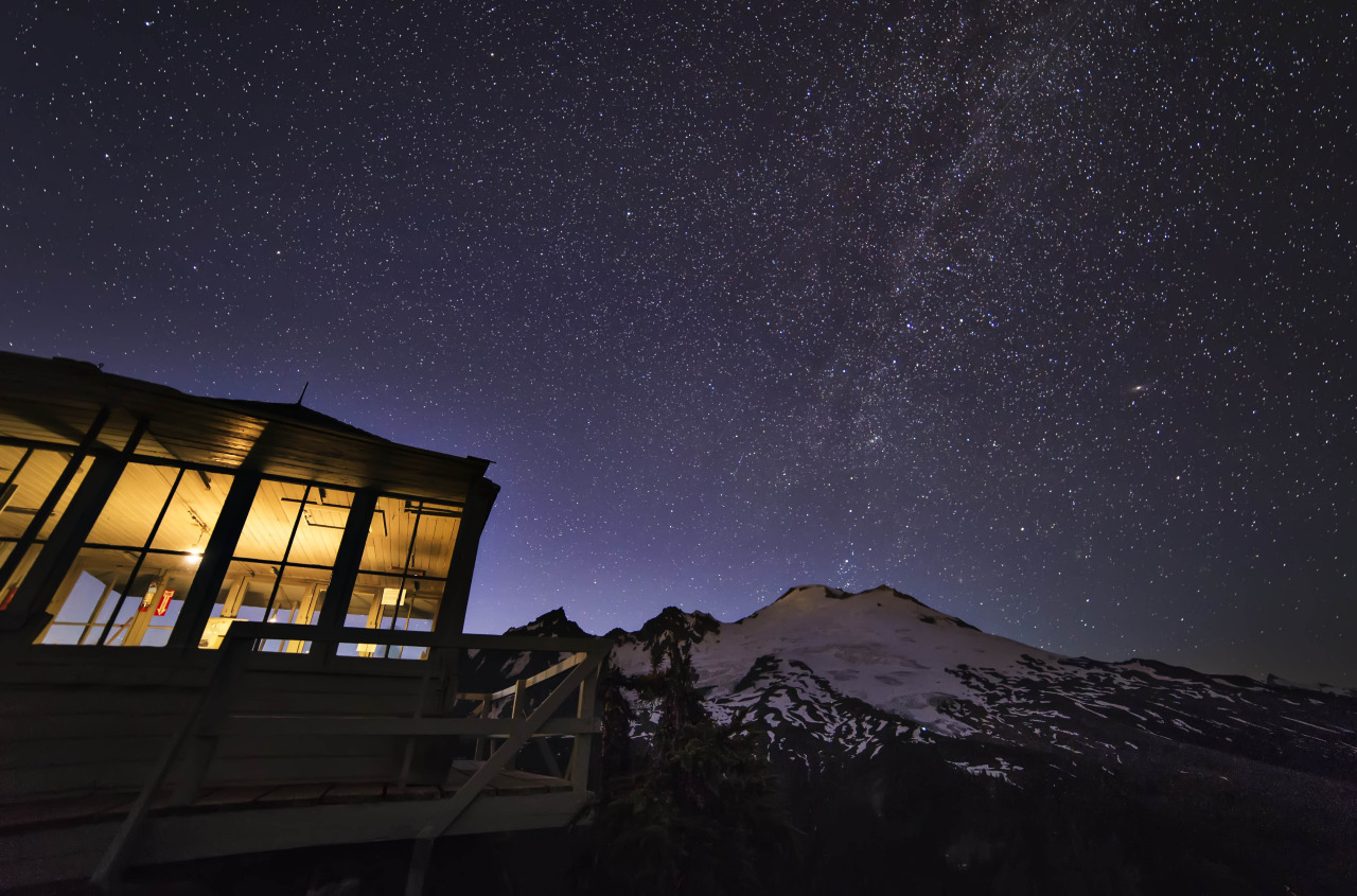
Written and Photographed by Valeriy Poltorak, Northwest Photographer
Bright and early one morning in August, long before the sun was out I decided to drive north and chase the sunrise. The drive out to Mount Baker National Forest was a very scenic but lengthy one from Tacoma so it made for quite the early morning. Despite the many hours of driving it took to get to this point it was well worth the early adventure.
Picture Lake and it’s surroundings offer gorgeous views, which are easily accessible year round. Whether or not you’re a morning person the experience you’ll get while visiting this beautiful park is one that I highly recommend. From sunrise to sunset the still water, lush greens and colorful skies create a moment that you’ll never forget!
Moments like this are the perfect reminder of why I enjoy exploring the great outdoors and the natural world around me! Discovering hidden trails, hiking up mountain ranges or even just walk along the beach the Pacific Northwest offers many unforgettable views that are just waiting to be captured! Take a moment today to go out and discover a park or natural area around you, guaranteed you will not be disappointed!
Valeriy Poltorak (@Mrvalography) is a photographer in the Pacific Northwest who enjoys sharing his journey and story in a visually captivating perspective. Traveling to all areas of the globe he is prepared to capture any moment without hesitation! See his work.

Written and Photographed by Sam Davis, Northwest Photographer
It was Fourth of July weekend, and not wanting to be surrounded by people blowing things up, my wife and I decided to load up the truck and head for the mountains. We had a better idea in mind for celebrating our independence and it consisted of a trip to Sahale Arm.
Our original plan was to snag a permit at the Marblemount Ranger Station and spend the night at the Sahale Glacier Camp, but unfortunately all of the spots had been claimed so we decided to make it a day trip instead.
Having been in the area before that year on El Dorado, I was excited to get a slightly different perspective from Sahale Arm of the surrounding peaks. After making it through the seemingly endless switchbacks, we were finally rewarded with open views of Johannesburg Mountain.
Continuing on the trail, we saw a few deer making their way through the brush and enjoying the beautiful weather and views. As we approached the Sahale Arm we were treated to breathtaking views of some of my favorite North Cascade Peaks including Eldorado, Forbidden, The Triplets and Mixup.
Having reached a great resting spot with 360 degrees of stunning views, we fueled up and soaked in the sunshine. Our plan was to enjoy the weather and take our time to explore. With the sun setting later in the day, we had enough time to take a nap and snap some pictures as we continued upwards towards Sahale Peak.
When we came across this particular meadow, I couldn’t believe that a place like this exists just a few short hours from the busy city. This spot was stunning to me because of its contrast. Here you are walking through a beautiful and soft meadow filled with wildflowers, while in the distance jagged mountain tops carve out the horizon. I dropped everything, grabbed my camera and hit the shutter button. This was definitely one of the most memorable scenes I’ve ever experienced.
We spent the rest of the evening enjoying a warm meal while watching the sky turn majestic colors as the sun began to set. It was hard to leave such a beautiful place and I look forward to returning soon.
Sam Davis grew up in the Pacific Northwest and currently lives in Seattle. He works as an accountant during the week and spends his weekends exploring the Cascades with his wife and dog. See more of his work: http://www.samdavisphotography.com/

Written and Photographed by Andy Porter, Northwest Photographer
The only thing that captures my imagination more than images of stark, forbidding mountains deep in the wilderness is images of the Milky Way.
The sense of wonder looking at a star filled sky…there is nothing like it. All of the themes evoked by such a sight: distance, space, infinity, the unknown, God, space travel, alien races, vastness, our insignificance…I mean, where else do you get such a mélange of emotions?
And when you add to the starry night sky the strip of the Milky Way, with its mottled colors of gaseous clouds, you are exponentially multiplying the element of coolness.
Combining wilderness photography with starry sky imaging is a natural. You need to escape from the lights of civilization to get clear shots at night and any wilderness; mountains, ocean, desert all provide spectacular foregrounds for the Milky Way.
Capturing Night Sky Images
The equipment list is rather meager. You need a decent DSLR (a full frame body is best, but not mandatory) a wide angle lens ( 10 to 20mm is best, 24mm is fine) a tripod and a cable release (or electronic shutter release) and that’s really all you need, equipment wise.
Once you get out to your spot and get set up set the camera on manual exposure mode and open your aperture up all the way (use the lowest f/stop number) and then, using the chart here, set your shutter speed.
As for ISO, that is really the only variable. Depending upon your camera I would suggest starting at a relatively low ISO, say, 1,000 and then work your way up, checking the images as you go. Each camera will have its own ISO sweet spot, often it’s the midpoint between the lowest and highest ISO setting on the camera.
One more important item is focus. You must set your lens on Manual Focus. Auto focus will not work at night and so, before you head out, take some time and figure out how to manually set the focus ring on your lens to infinity.
There are several way to do this, one is look up your lens on line, looking for the manual, or advice as to how to set that lens to infinity. Or another way is to sit with your camera (set the aperture open all the way when doing this) and take test shots of something at least 50 feet away and then review the image on your camera, using the zoom function and keep testing until you find that exact spot for your lens where its set for infinity, then make some mark or note or whatever so that when you’re out in the field at night you know where to set it.
That’s it! Then you can leisurely move about, composing shots and have fun (make sure to check your focus ring from time to time, moving your rig about can often change the focus setting!)
Here in Washington there are many fantastic places to go for night sky images. Mount Rainier, the Pacific Coast, along a wild river really the list is endless. Happy Shooting!
Andy is a nature photographer lured to Washington State by the glorious vistas. He lives along the North Cascades Highway, where he teaches photography and leads photo tours. You can see more of his work at: www.AndyPorterImages.com


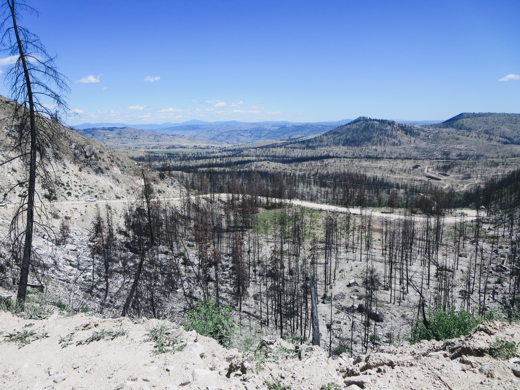

Wildfire’s Cycle of Renewal on the Eastern Washington Landscape
Written by Peter Goldmark, Commissioner of Public Lands, Washington State Department of Natural Resources
Photographs by Washington State Department of Natural Resources
In mid-June, I stood with TNC’s Washington State Director Mike Stevens and a group of biologists and foresters at the top of Three Devils Road, in the heart of the devastation wreaked by Washington’s 2014 Carlton Complex fire. As we looked across the valley in Okanogan County, we saw hills spiked with blackened trees, almost as far as the eye could see.
Under the glare of the June sun, I felt a renewed sense of grief for the loss of homes, habitat and forestlands taken by that firestorm, which had destructive power and speed unmatched in Washington’s wildfire history.
As Washington’s elected Commissioner of Public Lands, I have responsibility for the Department of Natural Resources, which manages 5.6 million acres of state-owned aquatic, forest, agricultural and rangelands. As part of that responsibility, I oversee the state’s major wildfire fighting force, which protects 13 million acres of state and private lands. I am also charged with protecting forest health.
The long-term health and resilience of this magnificent landscape was the purpose of our mid-June trip. Along with Mike and his TNC team, we had with us DNR foresters who have decades of experience in fighting fire and planting trees over these hills. In addition, we had renowned University of Washington professor Jerry Franklin, whose definitive work on forest ecology is essential reading for those of us who care deeply about this topic. University of Washington professor Jon Bakker, an ecologist with expertise in ecological restoration, brought an additional dimension of knowledge to our group.
What can we do to build resilience and help healthy forests flourish in this region? As we walked the hills and pondered, we noted how dry-pine forests in eastern Washington have extended their range over the last 100 years. There was discussion among us about the effect of that extension on forest health, and whether it might be the result of historic fire suppression.
As we looked closer at the burned landscape, we saw grass and wildflowers on some of the hills. Proud, old “yellowbelly” Ponderosa pines, native to our region, were standing scorched but alive in their groves. In other areas, small timber salvage operations were underway to assist local economic recovery and help DNR meet its obligations to the state trust.
While the people and the landscape will long bear the marks of the Carlton Complex, the cycle of renewal of this fire-prone landscape has begun again. This time around, we should strive to build resilience into these native forests that will help them better endure the inevitable vicissitudes of wildfire.


Guest blog by Gordon White, Program Manager, Shorelands & Environmental Assistance, Department of Ecology
Photograph by (1) Andy Porter, Northwest Photographer
What do we want our rivers and valleys to look like in ten years? How can we strategize and plan now so that we have reduced flooding, clean water and ample wildlife habitat a decade from now? Those are some of the topics that were tackled at Floodplains by Design Management meeting hosted by The Nature Conservancy, Department of Ecology and Puget Sound Partnership.
“Fun” and “enlightening” are not words you usually hear after an all-day workshop on a beautiful Friday in Seattle. Yet I came away from the gathering feeling I’d enjoyed myself and gained important new insights into our challenges and our work.
The workshop was a working session with key leaders and project proponents from across the region with an interest in advancing integrated floodplain management and implementing Floodplains by Design-like projects. It presented an opportunity to continue the dialogue on what “it” is; what makes for useful planning scales and timeframes; and how to talk about success measures and stories.
Bob Carey from The Nature Conservancy gave an overview of the Floodplains by Design initiative, which created a strong entry point for everyone to work from as they discussed the finer points of the program. Jim Kramer, who specializes in building collaborative programs and initiatives, facilitated moving the dialog from conceptual to specific.
Cogs began spinning for attendees when Carol MacIlroy, a specialist in natural resource planning, shared a regional vision and planning scale along with timing. Participants were challenged with how best to capture the multi-benefit approach in their watersheds and regions. The Nature Conservancy’s Kris Johnson of gave a clear explanation of a GIS tool that creates new possibilities for scoping projects, leaving participants eager to learn more and try the tool.
For a summary of the legislative process and the Capital Budget we turned to Tom Bugert of The Nature Conservancy. The time is critical for this kind of information, and participants were empowered to play a role in fostering a successful outcome to the current legislative session.
We covered a lot of ground in one day and it was truly a team effort – one that is sure to yield long term results around our region. Results that will help our communities and ecosystems thrive well into the future.
You can learn more about Floodplains by Desgn.
Related Blog Posts
Orting Honored for Puyallup River Project